Description
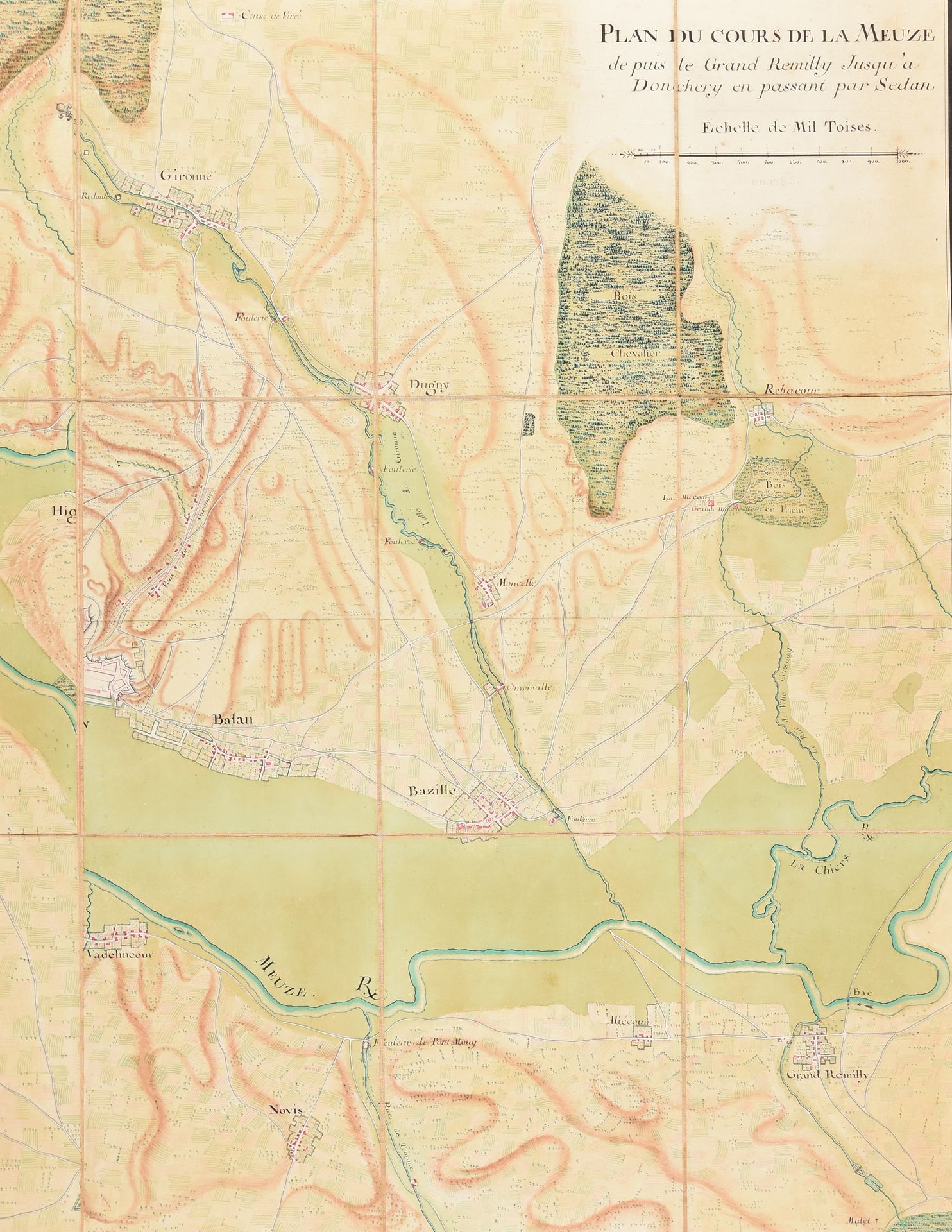
"Plan du cours de la Meuze depuis le Grand Remilly jusqu'à Donchery en passant par Sedan". 1736 Drawing, 89 x 123 cm, pen, black ink and watercolour. Mounted on cloth. Topographical map showing the course of the river Meuse in the Ardennes (northeastern France) with the fortified towns Sedan and Donchéry. Also represented are: "le Grand Remilly", the entrenchment near Floing, the available land for inundation at Grand Torcy, St. Mangis, Fleugny, Gironne, the "Censée de Virée", etc.
528
"Plan du cours de la Meuze depuis le Grand Remilly jusqu'à Donchery en passant par Sedan". 1736 Drawing, 89 x 123 cm, pen, black ink and watercolour. Mounted on cloth. Topographical map showing the course of the river Meuse in the Ardennes (northeastern France) with the fortified towns Sedan and Donchéry. Also represented are: "le Grand Remilly", the entrenchment near Floing, the available land for inundation at Grand Torcy, St. Mangis, Fleugny, Gironne, the "Censée de Virée", etc.