Kaerius, Petrus
Germania inferior id est, XVII Provinciarum eius novae et exactae Tabulae Geographicae, cum luculentis singularum descriptionibus additis a Petro Montano
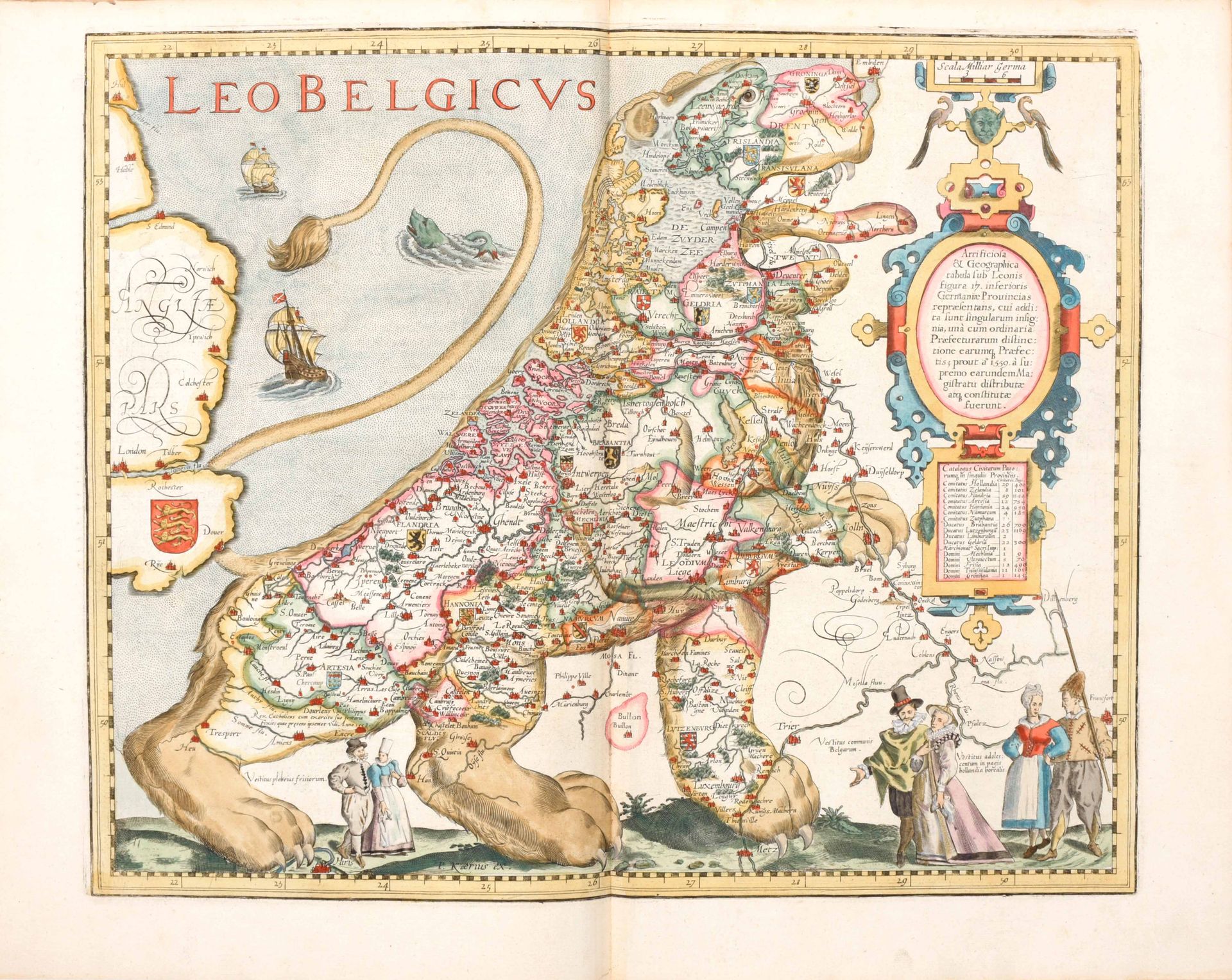
In-folio (ca. 42 x 28,5 cm), [viii], 94 pp, [2] ff, engraved allegorical title, complete with 25 engravings on double page : one history plate (with a small map and 5 figures of local costumes) + 24 maps. Entirely HAND COLOURED. One of the maps is the famous LEO BELGICUS, (2nd state) of the lion rampant facing right by Hendrik van Langren (1573-1609) which Kaerius already inserted in the 1617 edition. On the verso of the map the author refers to Michael Aitzinger as the first one to print this map. Many maps have beautiful traditional costumes, some have city views (Namur, Ghent, Antwerp...), some both. A few maps show sea monsters (17 Provinces, Leo Belgicus, Holland, Frisia...) Two marginal tears repaired, without loss. Some marginal annotations in brown ink. One map (Artesia) has pale stains in the margin. 18th century half vellum binding, pale marbled boards, a few stains on the boards
Second edition, first published in 1617. For this second edition the text was entirely reset; "Flandriae pars orientalior" (pl. 10) was replaced by the "Caerte van t'Vrije" by C.J. Visscher while the map "Typus Frisiae orientalis", now with text on the verso, is bound at the end Ref. Koeman Kee-2 ; Van der Heijden 2006, 4.2 ; Eenheid op papier, p. 31 (titelpagina van de 1617-editie) "Interessant is dat een Vlaamse cartograaf in Amsterdam, die in 1617 de mooiste atlas van de Nederlanden samenstelde die ooit gemaakt is, het belang van de boekdrukkunst en van het kompas zo goed besefte dat hij beide op zijn titelpagina afbeeldde."
Amstelodami
Petrus Kaerius
1622